Image Georeferencing
Aerial Photographs, Field Sketches, Trench Maps
Welcome! This site lets you upload an aerial photo, field sketch or map extract and overlay it onto a modern map. There are 4 steps:
- Upload an image file (JPG or PNG) from your hard drive (if it's not too large)
- Crop any white space or margins
- Tag it — at least 3 locations, then ...
Zoom, Stretch, Rotate, Scale!
We'll load it onto a modern map and you can rubbersheet it to fit.
Jump back and forth or come back later and pickup where you left off.
Instructions
Note: Cookies must be enabled in your browser.
Step #1 - Upload
- Browse to your local device.
- Select an image file that is of type JPG or PNG.
- Our current file limit is 1.75MB - this is not intended for entire trench maps.
- Upload your map to our servers.
Step #2 - Crop
- If your image contains no white space, margins, borders etc, simply click Continue without Cropping.
- Your image is displayed with a movable rectangle inside. Move the handles at each corner until you have cropped (removed) any components that are not part of the map.
- Drag the cropping area to another part of the map if required.
- You can change the background colour (ie the uncropped image). This may help as you adjust borders.
- You can also change the background opacity.
- Preview lets you see the cropped image prior to the next step.

- ↔ Move crop handle left or right
- Move crop corner out or in
- ↕ Move crop handle up or down
- Drag image
Step #3 - Tag
- Your map can now be zoomed into to show all features.
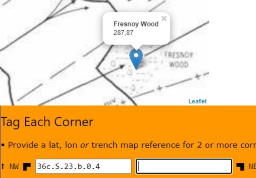
- For best fit, identify 4 points at each corner - give us a trench map reference or lat, lon.
- The closer you get to the boundary, the more accurate our initial position is.
- Optionally, give us one of the following:
- At least 2 corner points.
- Minimum of 3 points on the map, such as a church, cross-road or chapel.
- One 500 yard line and a north / south line (for sketch map, aerial photograph or non-standard map extract.
- Every option allows you to type in a name, such as Minden. We will search the Gazetteer and find the lat, lon for Minden Post.
- You will need to select the most appropriate entry for a generic term such as salient.
Step #4 - Rubbersheet
- We display a modern map, your overlay & tools to move, rotate, zoom, combo-zoom-rotate and rubbersheet.
- Initially we lock the image so you can assess the initial fit.
- We recommend you use the rubbersheet last — it is so easy to overstretch and end up with a distorted image impossible to unravel!
- Try this sequence:
- Move your image to align with pre-drawn reference points and lines.
- Zoom image to sharpen the fit.
- Rotate your image for fine alignment.
- Finally, use the rubbersheet for local stretching / shrinking at any corner.
- You can change the opacity of your image at any stage.
- There is a shortcut to rotate and zoom at the same time — note the warnings above and don't get lost or dizzy!
- When finished, lock the image so that you don't accidentally drag it somewhere else.
Toolbar Options 
- Move image
- Scale image
- Rubbersheet (distort-corners)
- Rotate
- Scale-rotate
- Unlock / Lock image
Sub-Notes
- Time spent determining the exact corners will guide how close our initial fit is.
- If you put the corner in as a trench map reference, such as 57c.J.16.b.3.1, then we will calculate the latitude and longitude for you.
Acknowledgements
All content on this website is © tMapper 2020
We use utilities from original Copyrighted Material or as licensed under Creative Commons or similar
- Step 2 uses the Jcrop cropping engine © 2008-2018 Tapmodo Interactive LLC, used under license.
- Step 3 uses Gazetteer of the Western Front, originally courtesy of John Reed, updated 2016 - 2020. Used under license.
- Step 3 uses Trench Names from tMapper, original source hand scanned maps.
- Step 3 & 4 uses Leaflet — an open-source library for mobile-friendly interactive maps.
- Step 4 uses Williams Aviation Formulary, but sources an implementation of Destination point given distance and bearing from start point.
- Step 4 uses Distortable Image library for Leaflet, part of Public Labs' MapKnitter support.
- Step 4 uses GD Library — dynamic creation and editing of images.


